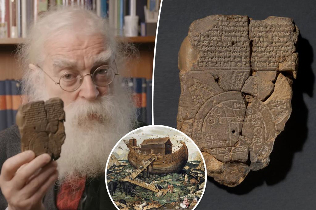
Scientists have deciphered the world’s oldest map – and they believe it could lead them to the location of Noah’s Ark.
The 3,000-year-old Babylonian artifact has puzzled archaeologists for centuries, but in recent weeks, experts have discovered the meaning.
The clay tablet was discovered in the Middle East before being acquired by the British Museum in 1882.
Irving Finkel, Curator of Cuneiform Clay Tablets at the British Museum, with the 3,000-year-old clay tablet. AP Photo/Sang Tan
Since its discovery, experts have been trying to decipher what the map-like symbols carved into the artifact might mean.
The tablet has several cuneiform paragraphs on the back and above the map diagram depicting the creation of the Earth and what existed beyond it.
The clay tablet was discovered in the Middle East before being acquired by the British Museum in 1882. British Museum
The carvings have been called the Imago Mundi by scientists who say it shows Ancient Mesopotamia, now known as modern-day Iraq, surrounded by the “Bitter River,” a double ring marking the boundaries of the known Babylonian world.
But after more than a month of analyzing the symbols on the tablet, researchers believe they are clear references to stories in the Bible. They claim that the back of the artifact acts as a secret key to tell travelers the route they will take and what to watch out for along the way.
“Because it is the description of the Ark that was built, theoretically, from the Babylonian version of Noah,” said British Museum cuneiform expert Dr. Irving Finkel. British Museum
One passage is said to say that those on the journey must travel “seven leagues to see something that is as thick as a purse.”
The word “parsiktu” is meant to help explain the size of a ship needed to survive the Great Flood, based on other ancient Babylonian writings.
Another passage is believed to show a path and directions to “Urartu”, a place believed to be where a man and his family landed a giant ark that they made, according to ancient Mesopotamian poems – most often referred to like Noah’s Ark.
The carvings are called Imago Mundi by scientists. British Museum
“Because it is the description of the Ark that was built, theoretically, from the Babylonian version of Noah,” said British Museum cuneiform expert Dr. Irving Finkel, according to The Sun.
Urartu, also known as Ararat, is on top of a mountain in Turkey and researchers say it is said to be where the ark landed after the 150-day flood.
“It shows that the story was the same, and of course one led to the other, but also, that from the Babylonian point of view, this was a real issue,” Finkel explained. “That if you go on this trip, you will see the remains of this historic boat.”
After more than a month of analyzing the symbols on the tablet, researchers believe they are clear references to stories in the Bible. British Museum
The biblical story of Noah’s Ark closely follows the Babylonian version. In the Babylonian version, the god Ea sent a flood on Earth to destroy all of humanity except for one family. Utnapishtim built a large ark after being ordered and filled it with animals.
The six months that followed had terrible floods that only Utnapishtim, his family and all the animals in the ark survived. With the end of the floods, they settled safely on one of the peaks of Urartu.
“In this account the details are given and God says ‘You must do this, this and this’ and then the Babylonian Noah says ‘I did this, this and this. I did it!'” explained Finkel. “And I made these structures like a thick parsiktu container.”
The biblical story of Noah’s Ark closely follows the Babylonian version. Fine Art Images/Heritage Images/Getty Images
While the story of the Gilgamesh Flood is recounted by several clay tablets dating back over 3,000 years, the biblical flood is said to have been around 5,000 years ago.
Whether the Turkish mountain of Ararat mentioned in Babylonian history exists is still widely debated.

